 Sale!
Sale! National Parks of the Canada National Geographic 30×42 Wall Map Poster – NG Maps
$23.96
$29.95
Quick Overview
Bring your wall alive with the world's gold standard of wall maps!Take a trip to the great outdoors, and the glorious natural wonders contained in Canada's National Parks, from the greatest cartographers on the globe, National Geographic.From the mapcollec
- Satisfaction 100% Guaranteed
- Free shipping on orders over $30
- 60 day easy Return
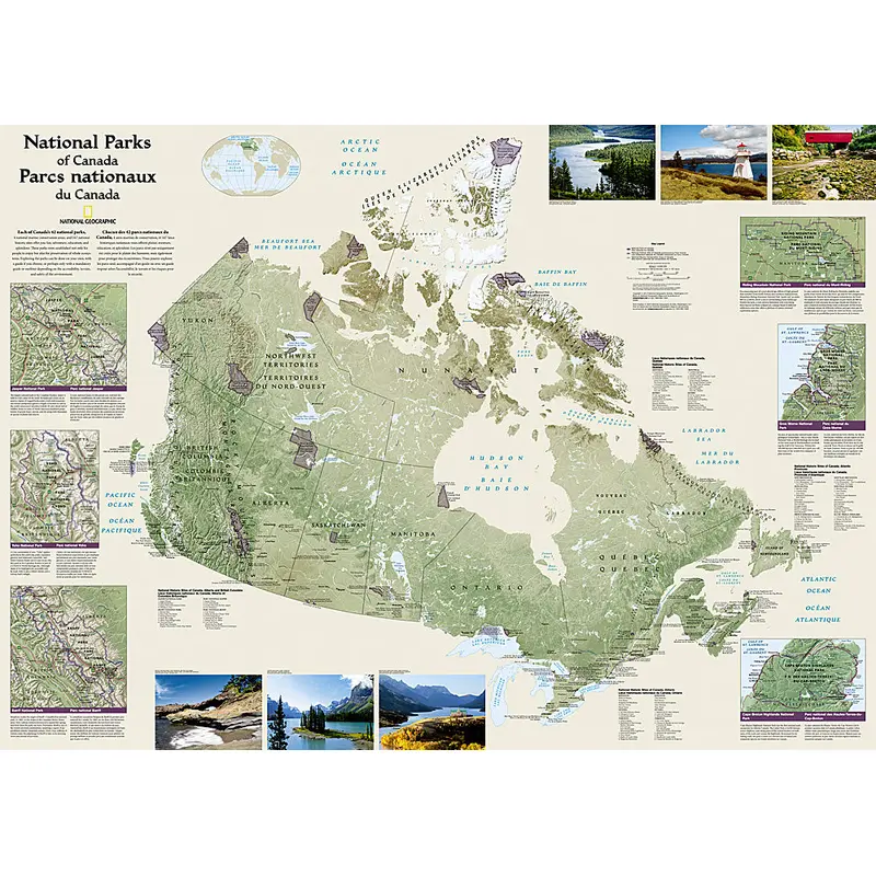
Bring your wall alive with the world’s gold standard of wall maps!Take a trip to the great outdoors, and the glorious natural wonders contained in Canada’s National Parks, from the greatest cartographers on the globe, National Geographic.From the mapcollectionyou’ve seen in classrooms, libraries, offices, coffee shops, and other public places all your life – now own one for yourself.
National Geographic’s wall map of Canada’s National Parks highlights the magnificent parks, marine conservation areas and historic sites across the country. This French-English bilingual map, is beautifully rendered with shaded relief and clear national boundaries of provinces and territories. Hundreds of cities, including provincial capitals are pinpointed and labeled in easy-to-read fonts. Colorful photos capture some of the diverse landscapes preserved and protected by the national park system. Separate inset maps provide detail and descriptions of several of the most popular parks including Jasper, Yoho, Banff, Riding Mountain, Gros Morne and Cape Breton Highlands.
This 30″ x 42″ edition is the perfect size – not too big, not too small – ideal for any wallof your choosing. Every lover of America’s wondrous landscape can use this piece as an accent to home, office, cottage, classroom, library, or other public facility. Make this yours!
| Cost: | $25 |
| Free Shipping | We offer free shipping on orders over $30. Please check the free - shipping eligibility at checkout. |
| Delivery Time: | It usually takes [3-5] business days for standard shipping. Please note that this is an estimated time frame and may be affected by local holidays, and unforeseen circumstances. |


Reviews
There are no reviews yet.